
01. Executive Context: The Strategic Value of Land Heritage
For the modern developer and acreage buyer, land is far more than a set of physical GPS coordinates; it is a living narrative of continuity, elevation, and stewardship. Understanding the historical trajectory of the Oak Ridge Road and FM 3081 corridor is essential for evaluating long-term residential and financial value.
The transition of the Deer Hollow Ranch site—from 19th-century Mexican land grants and frontier farming to a meticulously managed commercial timber preserve—offers a singular value proposition. The legacy of single-entity corporate ownership for over a century has preserved the landscape's ecological integrity, providing modern buyers a rare "land heritage" that balances industrial-grade architectural stability with pristine natural preservation.
02. Foundations of the Landscape: Indigenous Stewardship & Colonial Grants (Pre-1836)
Before the arrival of Anglo settlers, the dense Piney Woods ecosystem served as a vital transit and resource corridor. This dense forest of loblolly and shortleaf pine, fed by the watershed systems of Peach Creek and Caney Creek, supported rich biodiversity and served as a strategic passage for native populations.
The Significance of the Ridge Lines
The natural topography of the area was the primary architect of its earliest transit systems. The Bidai and Akokisa tribes, later joined by nomadic bands of the Alabama and Coushatta, utilized the high-ground ridge lines to navigate the region. They intentionally followed these elevations to avoid the gulfcoast downpours and the many beautiful creeks painting the distant basins with life.
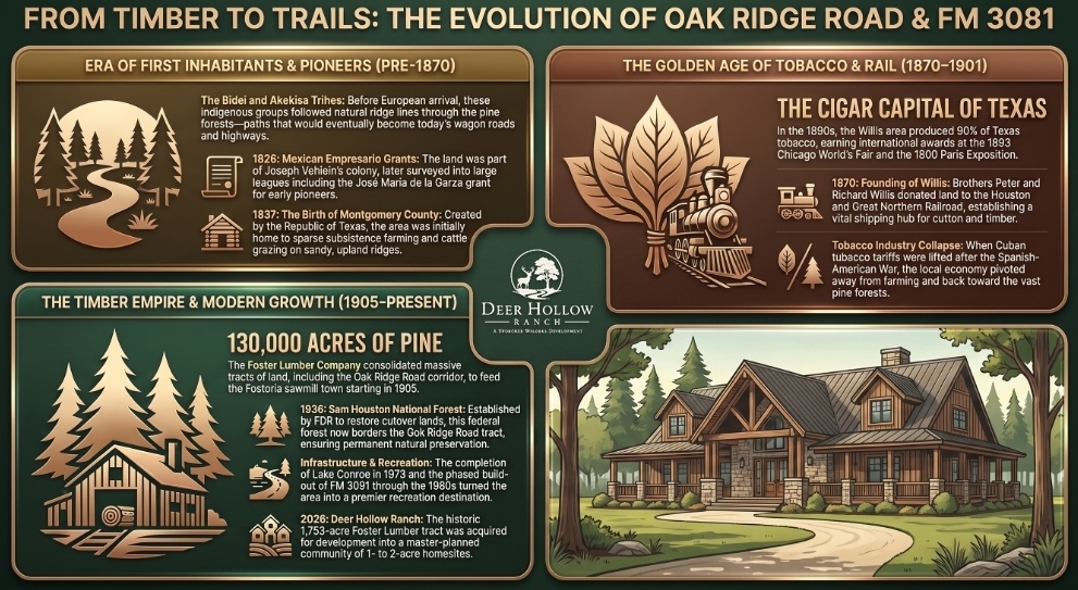
During the Mexican Colonization era (1820s–1836), the land transitioned into a formal colonial asset. Following Mexico's independence from Spain, the territory was included in the Joseph Vehlein empresario grant. Vehlein was tasked with settling the region, leading to the first formal partitioning of the landscape. Key early surveys, most notably the José María de la Garza grant, established the initial legal boundaries that define the Oak Ridge Road and FM 3081 area today. Following the formation of the Republic of Texas in 1836, these colonial leagues were integrated into the newly created Montgomery County in 1837.
03. The Agrarian Pivot: From Frontier Subsistence to the "Cigar Capital of Texas" (1837–1900)
Following Texas statehood, the economic utility of the land shifted toward specialized agriculture. While the sandy and acidic soil of the upland ridges prevented the rise of massive cotton plantations seen in the river bottoms, it dictated a unique and prestigious economic path for the region.
The Late 19th-Century Tobacco Phenomenon
By the 1890s, the Willis area achieved international renown through a historic "Cigar Boom." Agronomists discovered that the local sandy loam soil produced exceptional cigar-leaf tobacco that rivaled premium Caribbean and Cuban varietals. This specific corridor became known as the "Cigar Capital of Texas," with Willis producing nearly 90% of the entire state's tobacco output.
The area’s prestige was cemented on the world stage, winning top international honors at the 1893 Chicago World's Columbian Exposition and the 1900 Paris Exposition. During this era of growth, the regional geography was further refined; in 1870, San Jacinto County was carved out just west of FM 3081, placing this site in a unique border position that it maintains to this day (granting the coveted 1.68% county tax rate with $0 MUD).
04. The Industrial Legacy: The Foster Lumber Century (1894–1957 / 2026)
The arrival of industrial-scale timber harvesting at the turn of the century marked the most significant period of land consolidation in the site's history. The Kansas-based Foster Lumber Company acquired over 130,000 acres in the region, including the 1,753-acre tract that now comprises the core development area of Deer Hollow Ranch.
The Fostoria Mill Town & Ridge Tram Lines
Operations were centered at Fostoria, a massive sawmill company town southeast of the site. To transport timber, Foster Lumber constructed an intricate network of narrow-gauge tram railroads and logging roads that crisscrossed the ridges near FM 3081. These industrial routes utilized the exact high-ground logic established by early indigenous groups, further reinforcing the site’s natural transit corridors.
05. Infrastructure & Conservation: Defining the Modern Boundary (1936–1986)
In the mid-20th century, the site’s long-term value was further fortified by federal conservation and state infrastructure projects, providing the permanent "buffer" and "access" required for high-end acreage living.
- Sam Houston National Forest (1936): Established by President Franklin D. Roosevelt to reclaim cutover timberlands, this 163,000-acre forest created a permanent, non-developable federal boundary adjacent to the site. This ensures that the rural character, dark skies, canopy views, and wildlife corridors are federally protected in perpetuity.
- Lake Conroe (1973): The completion of the 21,000-acre lake transformed northern Montgomery County into a premier recreational haven, dramatically elevating residential demand while keeping this corridor quietly removed from commercial shoreline congestion.
- Highway Expansion of FM 3081 (1967–1986): The phased paving and expansion of FM 3081 by the Texas Department of Transportation was the final catalyst for modern utility, connecting the ridge corridor directly to I-45, Willis, and Conroe.
06. Modern Transformation: The Emergence of Deer Hollow Ranch (2020–2026)
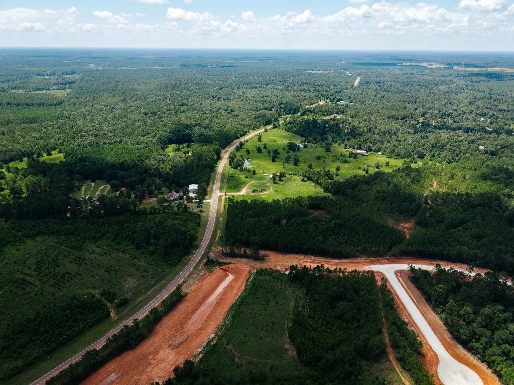
The current decade marks the final transition of the land from commercial tree farming to a premier master-planned acreage community. As suburban expansion moved north along I-45, the divestment of large timber holdings represented the highest and best use for this pristine topography.
The acquisition of the 1,753-acre Foster Lumber tract by Conroe-based Stoecker Wilgers Investments in 2026 concluded the site's industrial era. Originally conceived under the working title of Foster Creek Ranch, the project was strategically rebranded as Deer Hollow Ranch to honor its deep historical roots as an ancient white-tailed deer sanctuary and native pine retreat.
Respecting Topography Through Low-Density Living
The decision to develop strictly 1- to 2-acre homesites is a direct strategic response to the land’s history. By maintaining low density, the community respects the natural ridge-line contours and preserved pine canopy. Paired with Elk Ridge Homes' semi-custom architectural portfolio, Deer Hollow Ranch offers buyers the secluded freedom of the historic Piney Woods alongside modern fiber internet, wide paved roads, and full freedom for high-clearance RV garages and custom workshops:
07. Chronological History: The Oak Ridge / FM 3081 Corridor
| Era / Year | Historical Event | Modern Technical Significance |
|---|---|---|
| Pre-1820s | Bidai, Akokisa, Alabama, and Coushatta tribes traverse high ridges to bypass Peach & Caney Creek floodwaters. | Establishes the high-and-dry 280'+ ridge lines (100% FEMA Zone X today). |
| 1826–1835 | Joseph Vehlein Empresario Grant; José María de la Garza colonial league surveyed under Mexican law. | Creates the legal boundaries that still define Oak Ridge Rd and FM 3081. |
| 1837 | Montgomery County established by the Republic of Texas. | Formally incorporates the corridor into the Texas civic grid. |
| 1870 | San Jacinto County created; town of Willis founded as H&GN railroad depot. | Establishes the border condition yielding 1.68% county taxes + Willis ISD. |
| 1890–1901 | Willis becomes "Cigar Capital of Texas"; wins 1893 Chicago World's Fair & 1900 Paris Exposition medals. | Shift back to pine forestry after tariff repeal prevents agricultural deforestation. |
| 1905–1906 | Foster Lumber Company builds Fostoria sawmill and consolidates 1,753-acre tract. | Initiates 100+ years of single-entity tenure, preventing suburban fragmentation. |
| 1936 | FDR proclaims Sam Houston National Forest (163,000 acres). | Establishes permanent federal conservation boundary shielding the perimeter. |
| 1957 | Sawmill operations cease; land transitions to continuous commercial tree farming. | Maintains unbroken mature pine forest canopy for another 65+ years. |
| 1967–1986 | TxDOT approves and paves FM 3081 westward to Montgomery County line. | Provides modern paved arterial connection to Willis, Conroe, and I-45. |
| 1973 | Lake Conroe dam and reservoir completed. | Positions the site less than 25 minutes from premier regional water recreation. |
| 2024–2026 | Stoecker Wilgers Investments acquires 1,753-acre tract to create Deer Hollow Ranch. | 1–2 acre master-planned acreage community with Elk Ridge semi-custom homes. |